Fishing Access — Yellowstone River
Reference Map
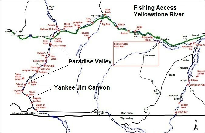
Fishing Access Site
Town / Landmark
Yellowstone River
Tributary
Reference map covering the major Yellowstone River fishing accesses from Gardiner to Pelican. Call for current conditions at any access.